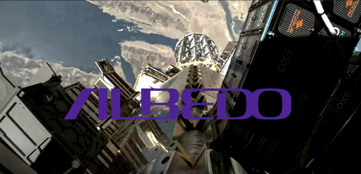
Albedo’s Clarity-1 satellite launches, establishes 1st contact + enters VLEO-specific protect mode
Albedo announced that their Clarity-1 satellite was successfully launched to orbit on SpaceX’s Transporter-13 Rideshare mission from Vandenberg Space Force Base in California on March 15th and the Albedo team made contact with the satellite and achieved key commissioning milestones just hours post-launch.
Just 14 hours after launch, Clarity-1 has successfully commissioned its precision GNC hardware and algorithms to transition between different operational modes, including Protect Mode. Then, Approximately four hours after separation from SpaceX, the Albedo team confirmed that the satellite was able to send telemetry and receive commands through its Mission Operations team.
 The Protect Mode is a specialized autonomous operating state that allows the satellite to maintain its orbit and perform necessary maneuvers without human intervention.
The capability is similar to a normal satellite’s “safe mode” but includes niche and essential functionality for operating in the challenging and dynamic environment of Very Low Earth Orbit (VLEO), where spacecraft experience significantly higher atmospheric drag, atomic oxygen exposure, and greater effects from solar events compared to traditional satellite orbits.
Clarity-1 is the world’s first commercial satellite designed to operate in VLEO. The satelllite reached its target orbit at approximately half the altitude of traditional Earth Observation (EO) satellites.
Clarity-1 will deliver10 centimeter visible imagery and 2 meter thermal imagery, previously only achievable using aircraft.
“This is a monumental milestone for Albedo, the United States, and our long-term ability to deploy exquisite capabilities for low cost into VLEO,” said AyJay Lasater, Co-founder and CTO of Albedo. “Clarity-1 will serve as the proof point that VLEO is the next frontier. Our mission centric view allows us to build exquisite capabilities at a significantly reduced price as we further develop our VLEO capabilities. We are excited to continue commissioning and calibrating Clarity-1 to provide our customers with unprecedented visible and thermal imagery.”
Clarity-1 has undergone commissioning steps and sensor calibration, altitude descent, and perform inclination adjustments to the satellite’s operational VLEO positioning.
Albedo builds VLEO satellites that collect visible and thermal imagery at the highest resolution commercially available. Later this year, the company will provide imagery-as-a-service to industries including agriculture, insurance, energy, mapping, utilities, and defense.
albedo.com
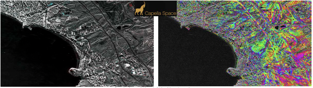
Capella Space: What’s the difference between SAR and InSAR?
What is Synthetic Aperture Radar (SAR)?
Let’s start with the basics: Synthetic Aperture Radar (SAR) is a powerful remote sensing technology that allows us to capture detailed images of Earth’s surface, regardless of weather conditions or time of day.
 Unlike traditional optical satellites, which rely on sunlight to illuminate the scene, SAR uses radar signals to ‘see’ through clouds, darkness, and even smoke. This makes it an indispensable tool for continuous Earth monitoring.
By transmitting radar pulses toward the ground and analyzing the signals that bounce back, SAR generates high-resolution imaging data of landscapes, cities, and natural phenomena.
Whether it’s tracking deforestation, monitoring infrastructure, or assessing natural disasters, SAR provides unparalleled clarity and reliability for global Earth observation.
What is Interferometric Synthetic Aperture Radar (InSAR)?
Interferometric Synthetic Aperture Radar, or InSAR, takes SAR to the next level by comparing multiple SAR images taken at different times.
This technique detects subtle shifts in Earth’s surface—down to millimeters—by analyzing changes in radar phase information. InSAR is a game-changer for applications like monitoring land deformation, detecting ground subsidence, and even predicting volcanic eruptions or landslides before they happen.
Here’s how it works: Imagine taking two SAR snapshots of the same location days, months, or even years apart. By comparing them, analysts can measure tiny shifts in terrain that might indicate underground movements, tectonic activity, or infrastructure instability.
This makes InSAR an incredibly valuable tool for governments, scientists, and industries needing to track environmental changes with precision.
Advancing SAR and InSAR Technology
Capella Space is pushing the boundaries of what’s possible with SAR and InSAR. Capella’s high-resolution SAR satellites provide persistent, reliable coverage of any location on Earth—day or night, rain or shine. This continuous monitoring capability is critical for industries and agencies that need fast, data-driven insights.
By integrating cutting-edge radar imaging with advanced data analytics, Capella’s technology enables near real-time monitoring of infrastructure, environmental changes, and even security-related activities.
Whether it’s detecting illegal deforestation, tracking urban expansion, or assessing the stability of bridges and dams, our SAR and InSAR solutions empower decision-makers with accurate, timely intelligence.
Why SAR and InSAR Matter for the Future
As our world faces increasing environmental and geopolitical challenges, the need for persistent, high-resolution Earth observation has never been greater.
SAR and InSAR are revolutionizing the way we monitor our planet, providing the insights necessary to drive smarter decisions, mitigate risks, and respond to emerging threats with confidence.
At Capella Space, we’re committed to advancing SAR and InSAR technology to ensure that governments, businesses, and researchers have the tools they need to monitor, predict, and respond to Earth’s dynamic changes.
The future of Earth observation is here—and it’s powered by radar.
www.capellaspace.com
Open Data Program
Capella’s constellation of SAR satellites delivers 24/7 all-weather Earth observation with the ability to penetrate atmospheric conditions, offering near real-time visibility even in cloud-covered areas, day or night.
We offer a constantly growing dataset of scenes from around the globe, supporting research work across forestry, glaciology, volcanology, oil spill detection, disaster response and more. This dataset includes multi-modal data consisting of geographically diverse areas of multiple land cover/land use types. Download SAR data through the Capella Space Open Data AWS S3 bucket.
SI Imaging Services: A new era of satellite imaging
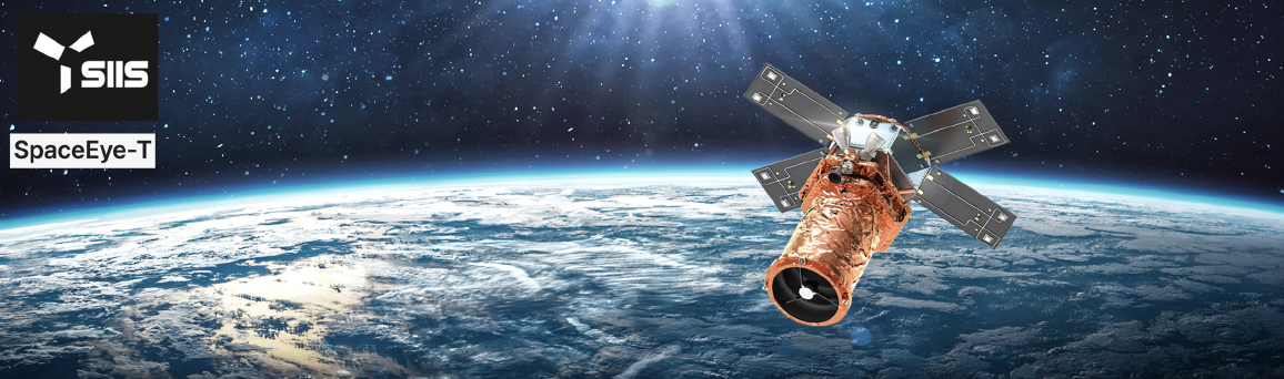
In March of 2025, the highly anticipated SpaceEye-T satellite was launched aboard SpaceX’s Falcon 9 Transporter-13 mission, marking a significant milestone in the evolution of very very high-resolution (VVHR) Earth observation technology.
SpaceEye-T is a high-performance, commercial, Earth Observation (EO) satellite developed by Satrec Initiative Group with 100% proprietary technology and capital. The satellite features a native resolution of 25 cm, a 12 km swath width, and a weight of approximately 700 kg and is now operating under SI Imaging Services to observe the Earth and enables unprecedented levels of detail for defense, mapping, urban planning, and environmental monitoring.
SpaceEye-T is not just another high-resolution satellite; it introduces an exclusive Satellite-as-a-Service (SaaS) leasing model. Unlike traditional satellite tasking models that require multiple users to share satellite resources, SpaceEye-T provides a single customer with exclusive operational control over a designated region. This ensures real-time access to imagery without competition, offering full sovereignty in satellite tasking and data acquisition.
Key Benefits of SpaceEye-T’s Leasing Model
Direct Tasking & Exclusive Operational Rights Customers have full, exclusive control over tasking and downlink operations. SI Imaging Services (SIIS) does not retain any records of the collected data, ensuring absolute privacy. Highest Commercial Resolution SpaceEye-T offers a native 25cm resolution, making it the most advanced commercial-grade satellite available for lease.
Uncompromised Security & Encryption Data transmissions are fully encrypted, and only the leasing customer has decryption access. Additionally, SIIS has no visibility into the areas tasked or data collected, with automatic data deletion ensuring absolute confidentiality.
Expanding to a Constellation
The launch of SpaceEye-T is just the beginning. By 2028, SIIS plans to deploy a constellation of four SpaceEye-T satellites, significantly enhancing revisit rates and ensuring near real-time global coverage. This expansion will provide clients with increased access to VVHR imagery, reducing the time between acquisitions and supporting time-sensitive applications such as disaster response, defense operations, border security, and environmental monitoring.
With four satellites on-orbit, users will be able to monitor areas of interest with greater frequency and consistency. This will provide strategic advantages for organizations requiring persistent surveillance, including defense agencies, intelligence sectors, and infrastructure monitoring teams. Additionally, the constellation’s expanded coverage will allow governments and commercial clients to respond to crises more effectively, whether tracking natural disasters, illegal activities, or geopolitical developments. The planned four-satellite constellation will further solidify SIIS’s position as a leader in next-generation Earth Observation.
A New Era of Commercial Satellite Leasing
With SpaceEye-T’s innovative leasing model, SIIS is redefining how governments and businesses access satellite intelligence. By offering exclusive control over an entire satellite, SIIS ensures customers receive real-time data tailored to their specific needs, free from competition. As industries increasingly rely on VVHR satellite imagery for strategic decision-making, the demand for dedicated satellite leasing is expected to grow. SpaceEye-T’s entry into the market paves the way for a new standard in Earth observation services, combining security, flexibility, and VVHR capabilities.
Looking Ahead
SIIS is already preparing for the next steps in advancing satellite technology and expanding global partnerships. With a vision to make satellite intelligence more accessible and customizable, SIIS continues to push the boundaries of what’s possible in remote sensing. SI Imaging Services provides satellite imagery from the Korean Multi-Purpose Satellite (KOMPSAT) 3, 3A, and 5. SIIS contributes to the remote sensing and Earth observation industries with very-high-resolution optical and SAR images together with more than 150 partners worldwide.
www.si-imaging.com
Tenchijin selected as data service provider of JAXA’s ALOS-4
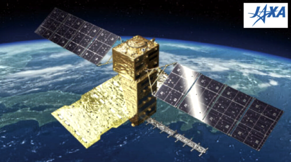
Artistic rendition of the Advanced Land Observing
Satellite -4 (ALOS-4) on-orbit. image courtesy of JAXA