
As Mankind continues to explore the Universe, maintaining a focus on developing international space missions to preserve the Earth is definitely important.
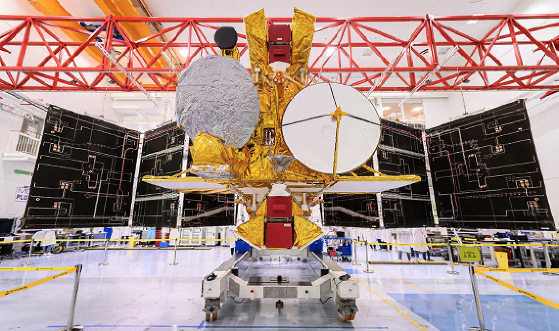
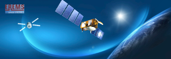
Photo of the Surface Water Ocean Topography (SWOT) satellite, courtesy of Thales Alenia Space
The Surface Water Ocean Topography (SWOT) satellite/mission is a perfect example of the success of international cooperation between private and public branches within the framework of protecting Earth.
Understanding Our Planet

The SWOT mission is an important international mission that involves cooperation between the USA, France, UK and Canada, through their respective space agencies, as well as industrials and Small and Medium Enterprises (SMEs). Led by NASA and the CNES French Agency, the SWOT mission aims to probe about 90% of the surface water on planet Earth and help to “determine temporal variations in surface water stocks (lakes, reservoirs and wetlands).”
Thanks to many altimetry satellites on-orbit, such as Topex-Poseidon (1992-2005), Jason-1 and Jason-2 (from 2001) followed by Jason-3 and soon by SWOT, it becomes possible to have more and more precise, continuous, climatological records of the average sea level.
For more than 25 years, these aforementioned satellites have allowed scientists to understand the system of currents that runs through the oceans’ surface and at depth, a system that represents massive energy transfers and is one of the main drivers of climate change. Currently, there is a 3.5 millimeter rise of the sea level every year, when previously that measurement was only 1.7 millimeters between 1993 and 1994.
“Ocean altimetry, i.e., measuring sea level from space with extreme accuracy over the entire surface of the globe, has been a real revolution,” said Eric Thouvenot, head of the Jason-3 program at CNES. “Previously, we only had local instruments that were not very accurate: tide gauges.”
The SWOT Mission: Surface Water + Ocean Topography
As can be read on the mission’s website, “satellites have already revolutionized oceanography, and tomorrow they will do the same for hydrology,” thanks to new embedded technology, such as the KaRIn equipment (that stands for Ka-band Radar Interferometer).
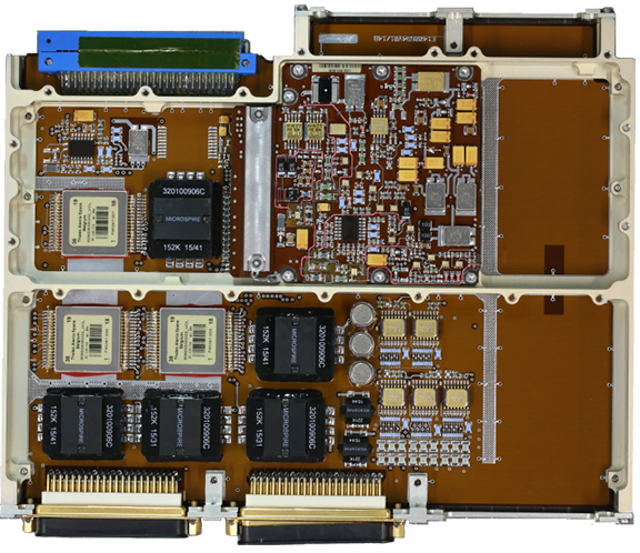
SWOT3 Remote Terminal Unit (RTU), photo courtesy
of EREMS
“With its two radar antennas perched at the end of a 10-metre boom, KaRIn will afford continuous coverage of a 120-kilometre swath,” when previous satellites could only cover a few kilometers under their perimeter.
The equipment will also be able to “acquire measurements of surface water height in more than 100-meter-wide rivers as well as lakes and flood zones with a surface area of 250 x 250 meters, with 10-meter accuracy, and to quantify slopes with a 1.7 cm/km accuracy (after averaging on a >1 km2 water surface area)” making it 10 times more accurate than current measurements.
As a mission of international cooperation, many actors participated in the development of the satellite; however, as prime contractor, Thales Alenia Space developed a new-generation platform that will enable a controlled re-entry of the satellite at the close of its life. Thales Alenia Space handled the satellite assembly, testing as well as the integration phases. An artistic rendition of the SWOT satellite on-orbit, courtesy of Thales Alenia Space.
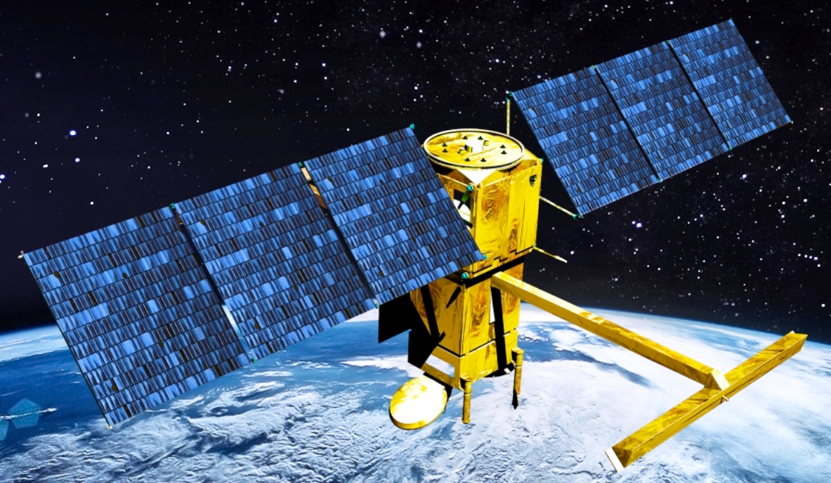
An artistic rendition of the SWOT satellite on-orbit,
courtesy of Thales Alenia Space.
Erems project team in clean room around RTU before delivery. Photo is courtesy of the company. Thales Alenia Space also provided for the payload — the radio frequency unit (RFU) at the heart of the Ka-band radar, interferometer instrument, as well as a dual-frequency, Poseidon altimeter, already onboard the Jason satellite family, for the NADIR subassembly.
The payload was integrated by JPL in Pasadena, California, and was assembled on the SWOT spacecraft at Thales Alenia Space’s plant in Cannes, France, last year. Before, in 2015, the Thales Alenia Space CEO declared that the company would use at least 15% of the services of French SMEs, such as EREMS, a Toulouse-based company that was been actively involved in the program through direct association with Thales Alenia Space Belgium. Together, they provided the Platform RTU (Remote Terminal Unit) to Thales Alenia Space Cannes. This electronic equipment, at the heart of the satellite, interfaces with most of the other satellite equipment onboard.
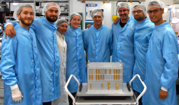
Erems project team in clean room around RTU before
delivery. Photo is courtesy of the company.
In collaboration with TAS Belgium, EREMS managed the design and production of several of the satellite’s 15 electronic modules, in parallel with the mechanical design of the equipment. Thus, for the modules associated with the interfaces of the propulsion system of the satellite, as well as those associated with the interfaces of the power distribution system, EREMS has, on its site in Toulouse, implemented all the electronic schematics. The company also optimized the selection of components, according to the constraints regarding the satellite, carried out all the electrical justifications and then implemented the boards before ensuring their manufacture, testing and integration process, prior to the delivery of the complete unit to TAS Cannes for platform integration.
“This international collaboration in the service of Planet Earth, is another success for EREMS, such as the COPERNICUS European program, or MicroCarb satellite, to measure CO2 flows, for which EREMS delivered differing Front End Electronics detectors. SWOT is another one of the several international environmental monitoring missions in which the EREMS teams are proud of their participation through the provisioning of major electronic equipment,” said Gérard Dejonghe, EREMS Chairman and CEO.
The launch of SWOT satellite is expected to occur in November of 2022 aboard a reusable, SpaceX. Falcon 9 Launcher.
www.erems.fr/en/