
Satellites help us stay online, make payments, and contact our loved ones. They affect every sphere of our daily lives, so it is high time we discovered some satellite facts to understand which tech helps us with routine tasks.
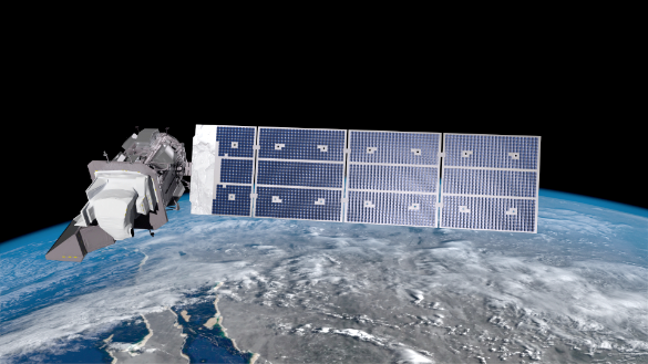
Artistic rendition of the Landsat 9 satellite on-orbit. Image is courtesy of NASA.
Taking pictures from the space sounds interesting, doesn’t it? This is one of the primary satellite uses since their inception. Satellites can point their cameras both at Earth and the endless void of space.
Here are a few satellite facts for youngsters. The Hubble Space Telescope is a scientific device that has helped scientists look closely into different, free-floating objects and planetary surfaces in space. But did you know it weighs as much as a regular school bus, which is around 24,500 pounds?
How Does Google Earth Take Pictures?
Perhaps the largest and most groundbreaking use of satellite cameras was done by Google for their Google Earth project. If you have used Google Earth before, you already know you can see satellite, aerial, 3D, as well as street view images.
Here are a few satellite facts for you. With technological advancement, satellite cameras can take pictures with 50 centimeter resolution or higher. This means that satellites can pick up a regular dining plate lying on a normal size baseball field with crisp and sharp details.
How does Google Earth use satellites to take pictures of our planet? Satellites will take multiple pictures over time, and Google will turn them into a single mosaic.
Do we benefit from these images?
Suppose you are planning a vacation next month in a foreign county. You might be able to look at how a hotel’s rooms look from their website. Smart people will also ask...
• How far away is the nearest parking,
• Is there a park where I can go out for a walk in the evening,
• What does the neighborhood look like,
• Is there a shopping mall where I can buy some gifts for my friends and family back home
To answer these questions, a person can quickly go to Google Earth online and scan the exact location they plan on staying using the information procured from satellites.
Another benefit of Google Earth and its satellites is that if you plan on buying a property, you can scan the surroundings from this app before confirming a purchase decision.
If you are concerned about your privacy at the moment, know that Google Earth does not allow real-time tracking. This means satellite images you will find on Google Earth were most probably taken months previously. Your current location is not compromised by Google Earth or the satellites behind it.
We have seen fiery comets flying into the Earth’s atmosphere in Hollywood movies. However, did you know comets are also referred to as “cosmic snowballs?” This is because comets are mostly comprised of ice, gas, dust, and rock. A comet will only catch fire when it enters the Earth’s atmosphere.
Another fact about comets is that scientists have, so far, discovered more than 3,000 comets in space — go ahead and impress your friends with certitude.
How Does NASA Take Pictures of Earth?
Satellite pictures from space have played a crucial role in shaping our perspective about the Earth and the planet’s surrounding. For instance, we have all seen the famous picture taken by Apollo 8 Astronauts back in 1968. This picture captured the Earth rising over the lunar horizon. A single picture has awed us into contemplating how small the Earth is from space.
NASA has a dedicated mission for taking pictures of the Earth from space, which goes by the LandSat satellite series name. Since it was launched in 1972, this satellite has been capturing amazing images of Earth’s surface and returning them to research facilities located on Earth.
Satellites launched by NASA don’t take pictures of just the Earth alone. Over the years, satellites have taken pictures of different nebulas, planetary surfaces, deep space images, close-up orbital snaps, and comets.
Talking about comets, here are some Halley’s Comet facts. This comet was first seen in 240 BC. When the comet comes close to the sun, it reflects a bright appearance that can be seen from our planet with a naked eye. The most astonishing fact about this comet is its sheer size. Unlike other comets, the Hailey’s Comet is 9 miles long. Now, that’s one, large comet!
Takeaways
Before concluding, let’s see how beneficial satellite images are for mankind. In August of 2020, the NOAA-NASA Suomi NPP satellite took nighttime images of the California wildfires. The images, captured using the VIIRS (Visible Infrared Imaging Radiometer Suite), helped rescue workers grasp the situation’s gravity and derive a solid, emergency plan.
Similarly, back in 2013, police in Oregon received a tip about a local growing marijuana plants in his backyard. To confirm this information, they took a look at Google Earth satellite facts and saw multiple rows of marijuana plants. The images helped the police raid and apprehend the illegal marijuana dealer.

There can be little doubt that satellites do make our lives better.
Thomas Glare is a science writer and space reporter. He graduated in Chicago before moving to the Netherlands to start building his career. His work is located at the intersection of STS and international relations, with special emphasis on space programs and security.