
The ecosystem around satellite remote sensor data and how it‘s consumed is rapidly evolving — as are the expectations of what that data should be delivering. Our demand for satellite-enabled insights is growing, and new approaches are needed to keep pace. Data Explosion
In recent years, we’ve become inundated with data, both in terms of the sheer volume being collected as well as our seemingly insatiable appetites for the knowledge it can deliver. On the supply side, there’s been a rapid rise in commercial remote sensing constellations. In the synthetic aperture radar (SAR) domain alone, the number of satellites (close to 60 now) has more than doubled in just 3 years. This has resulted in petabyte, and soon to be to exabyte levels of data (that’s over one billion gigabytes) being beamed to Earth.
On the demand side, consumers are adopting an attitude of data as a human right, as if our access to it should be as uncontested as our right to life-sustaining water. We increasingly expect to have the information we need at our fingertips for any given subject. The COVID-19 pandemic has only exacerbated this trend over the past year as remote work and schooling have contributed to a persistent, and pervasive digital environment. What’s more, as movement around the world more or less ground to a standstill, geospatial analytics gave us a unique lens through which to see and understand impacts to manufacturing, construction, infrastructure, the environment and many market verticals.
Now, whether a source of change is due to unexpected events such as natural disasters, natural trends, or human activity, we have come to feel that it’s our right to have relevant and up-to-date information about what’s happening around the world. This hunger for information is a strong reminder that raw data alone isn’t enough, but rather the answers that data provides are the key driver.

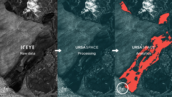
Ursa Space processed raw SAR imagery taken off the southeast coast of Mauritius in August 2020 and applied analytics to detect an oil spill caused by a grounded ship.
The Stories Behind Each Satellite Image
To answer questions about changes in a physical object or area of interest, and why that change has occurred, the power is in looking at it (and its surroundings) through a variety of lenses. While a satellite image can be informative on its own, layering on context, both in the form of multiple data sources as well as derived analytic insights, allows for a more complete story than pixels alone. When used in combination, geospatial sources such as optical, radar, and RF mapping can be fused to create additive intelligence about what’s going on in a particular space. Each type of data source offers its own advantages, and when it comes to a comprehensive story, the combinatorial sum is greater than each individual type.
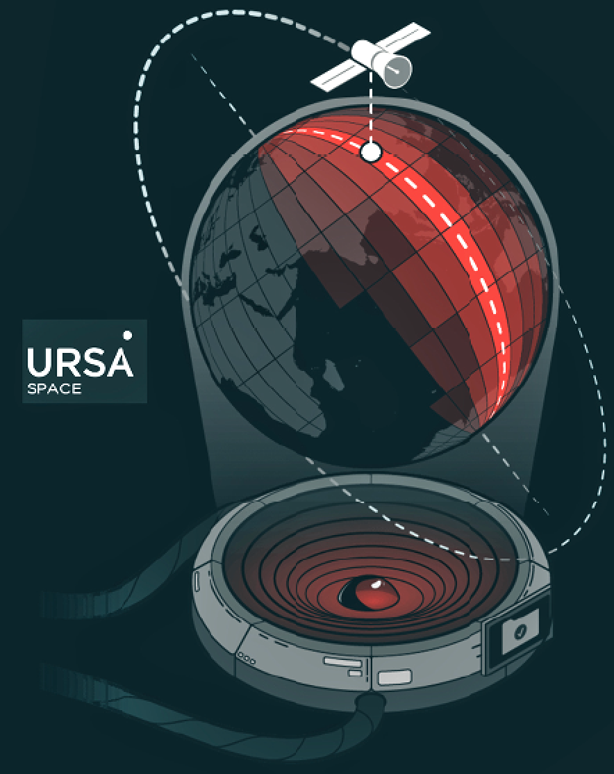
As a data source, SAR stands out due to some distinctive attributes. From this very rich source, one can extract information pertaining not only to the location, but also other metrics, such as the speed and direction of an object of interest. On top of that, SAR data can be collected any time, night or day, regardless of weather. When combined with other geo-referenced sources, the results can be very powerful. Something that at first looks static, becomes multidimensional and much more actionable.
Timing Is Everything
One very important caveat is that in many cases, in order for data to be truly useful, the data and resulting analytic need to be available at the right time, and responsive to the right need. For example, in order to do an effective job, a special operator needs to know what’s happening around a particular corner, at a specific moment in time. Wait a week to get that same piece of intelligence, and it will no longer hold the same relevance.
Depending on how the data is to be used, the timeliness of access can be critical. As we actively seek to whittle down the timelines associated with acquiring and processing satellite data, we’ll be able to address new and longstanding questions. Being able to apply SAR data in realtime will be an incredible game changer.
Solutions-Based Approach
In the realm of satellite data, gone are the days wherein companies simply put a predetermined product on the shelf and push it to the market. Instead, we are pivoting to a solutions orientation, where it’s really about customer intimacy, and beyond that, user intimacy.
As a satellite data and analytics provider, Ursa Space Systems is keenly interested in understanding its end users’ key requirements. This allows it to use its products and tools to provide tailored answers that meet a particular customer’s needs. And because the company works across satellite technologies and constellations and is not beholden to one over another, it’s technology agnostic.
As the amount of data explodes, Ursa Space Systems is at a pivotal juncture of finding new concepts to turn that data into the usable information people are so hungry for. This is where AI driven algorithms and cloud processing come in—they support at-scale, rapid processing. What’s really exciting is how unique approaches like that of Ursa Space Systems can be applied to novel solutions so that the satellite data analytics value chain can be expanded to new applications and markets.
Each aspect touched on — the amount of satellite data, our appetite, time- to-delivery and the end user applications — feeds the other. The resulting unprecedented accessibility and ability to glean insights from this firehose of data is having a huge, transformational impact—on industries, communities and ultimately the way we live and operate.
info@ursaspace.com www.ursaspace.com

Nicole Robinson is the President of Ursa Space Systems, a leading satellite intelligence and data analytics provider leveraging a global virtual constellation of +200 SAR, earth observation and RF satellites. In her role, she is responsible for taking the company from a start up to a scale up in accelerating the company’s growth globally while optimizing operations.
Ms. Robinson also serves as the President of Society of Satellite Professionals International (SSPI), the largest professional organization in the space and satellite community. Prior to joining Ursa Space, Ms. Robinson was the Senior Vice President of Global Government for SES, the largest commercial satellite operator in the world.

Ms. Robinson is certified in Federal Financial Management by the Federal Training Center, completed her bachelor’s degree in Communications at Radford University, earned an MBA from Liberty University, and is a graduate of the Senior Executives in National and International Security Program at Harvard University, Kennedy School of Government.