
Maxar’s SecureWatch, the company’s cloud-based platform for easy access to satellite imagery and geospatial intelligence (GEOINT), now includes TCarta’s Global Marine Basemap as a base layer, providing critical context for missions within the maritime and coastal zones.
Bathymetry is the measurement of depth of water in oceans, seas and lakes. TCarta aggregates thousands of publicly available and proprietary data sets including its own Satellite Derived Bathymetry (SDB), to create Global Marine Basemap, which is a hill-shaded, colorized base image with contours and marine features.
Coupling Maxar’s optical and radar imagery with contextual understanding of the ocean’s depths equips defense users with critical mission-planning information when operating in the marine domain.
In addition, SecureWatch users can take their mission to new depths by ordering higher-fidelity SDB and seafloor classification of coastal areas with delivery inside SecureWatch or offline. With access to the highest quality bathymetric data available via remote means, analysts can be better supported during their missions.
Both the Global Marine Basemap and higher-fidelity SDB products support numerous coastal GEOINT use cases, including:
• Amphibious landing planning in denied coastal regions
• All-source fusion for coastal defense
• Humanitarian assistance and disaster response
• Infrastructure planning
Click to enlarge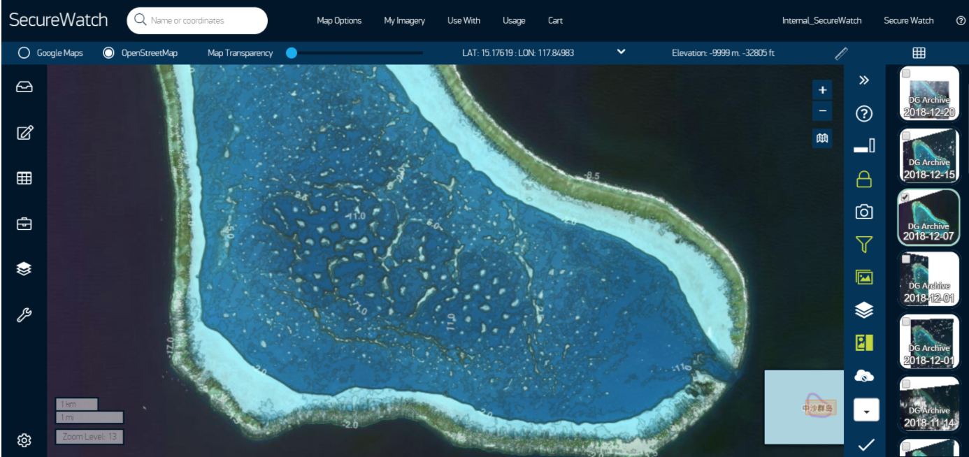
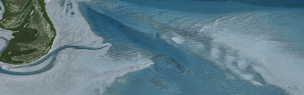
Remote islands and atolls in the Pacific Ocean are hotly contested locations and of great international interest as neighboring countries vie for naval control over the economically important region. Island building and fortification has accelerated in recent years, and SDB plays a vital role in deciphering military strategy in the region.
SDB allows analysts to measure dredging activities by adversaries around these islands, creating an advanced awareness of the fortifications and an understanding of what vessels can enter the protected lagoons.
From a tactical perspective, SDB gives intelligence officers a three-dimensional model of the seafloor, facilitating the preparation and planning of amphibious landings. This allows for full analysis of the area of operation when used in conjunction with Maxar’s high-resolution imagery and ancillary datasets. Advanced planning of go/no-go locations allows for the best options to be selected and presented to decision makers.
In the areas where a boat or aerial survey is infeasible due to the political and tactical landscape, satellite-based technologies, such as SDB and seafloor classification, provide valuable and actionable remotely-produced insight into these inaccessible areas.
All users will have access to the Global Marine Basemap within the ‘Map Option’ header on SecureWatch. Users that order the higher-fidelity SDB can access this dataset via the ‘Layers’ panel.
Click to enlarge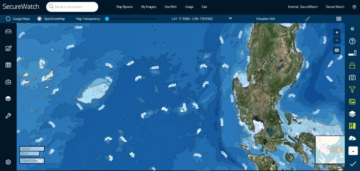
What is Satellite-Derived Bathymetry?
SDB is a remote method of surveying the seafloor using multispectral satellite imagery. Creating a seafloor digital elevation model (DEM) using on-the-ground methods, like sonars on boats, can be challenging in coastal areas due to environmental hazards like waves, currents and known or unknown navigational hazards.
TCarta deploys advanced physics-based algorithms to calculate water depths from zero – 30 meters using Maxar’s WorldView satellite imagery, producing a two-meter resolution DEM of the seafloor. TCarta creates this accurate SDB survey of broad areas rapidly using this technique.
TCarta focuses its efforts on the “white ribbon,” the coastal area where terrestrial mapping techniques fail and the areas are too shallow or remote for marine surveys, which leaves blank white spaces with no data.
Where conditions permit, SDB delivers a cost-effective and completely remote method for mapping these areas, thus filling in the data gap with modern information using proven marine remote sensing techniques.
TCarta validates its SDB data layer using secondary space-based methods including ICESat-2 LiDAR data and through-the-water stereo photogrammetry using WorldView imagery.
Stereo photogrammetry produces precise elevation measurements of seafloor targets by imaging the same area from two or more different angles.
Remote validation of SDB enables end users to understand and confidently use the shallow water elevation data in their operations because they have access to precise uncertainty reporting in the delivered data.
To view SecureWatch in action, please visit:
https://bit.ly/SW-TCarta
• To learn more about the TCarta SDB data layer, including detailed product specifications, please visit:
https://bit.ly/SW-SDB-data-layer
• This article is courtesy of Maxar’s Blog and is republished with the firm’s permission:
https://bit.ly/SW-Maxar-blog