
Inmarsat to launch their I-8 satellites to further empower their L-band network
Inmarsat has announced that SWISSto12 will develop the company’s new, eighth-generation of spacecraft — these three I-8 satellites will provide additional network resilience.
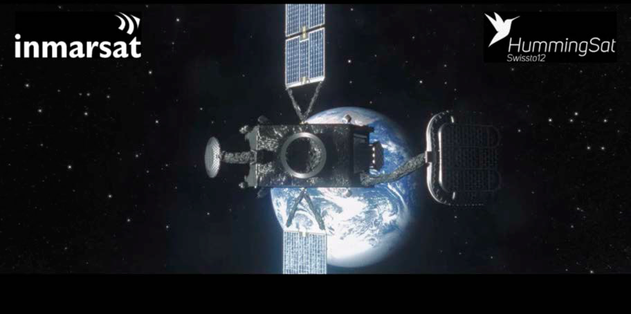
SWISSto12, headquartered in Switzerland, will use their HummingSat satellite platform — in conjunction with unique 3D-printing technologies and specialized Radio-Frequency (RF) and payload products — to develop and manufacture the geostationary satellites, which will launch by 2026.
Just 1.5 cubic meters in volume, the I-8’s will use SWISSto12’s new class of spacecraft that has a form factor up to five times smaller than conventional geostationary satellites, yet can still deliver critical safety services with full certainty.
The three l-8 satellites will continue to provide the extra layer of resilience to complement the existing constellation and Inmarsat’s two, I-6 generation satellites that were launched in December of 2021 and February of 2023.
In March of 2023, Inmarsat announced the first, I-6 F1, had successfully completed testing with ground stations in Western Australia and has now started to provide Ka-band services for the fast-growing Asia Pacific region. The company will begin introducing their L-band capacity and transitioning services to the new satellite throughout 2023.
The second, I-6 F2, which launched in February of 2023, is expected to enter operational service over Europe, Africa, and much of the Americas in early 2024.
Each I-8 will also extend Inmarsat’s history of launching and operating radio navigation transponders for Governments and international space agencies. These transponders can enable Satellite-Based Augmentation System (SBAS) services around the world, for example for air traffic controllers or coastguards. SBAS systems use satellite connectivity, land- based infrastructure, and software to enhance standard GPS/Galileo accuracy of 5 to 10 meters to as little as just 10cm.

Such precise tracking could enable pinpoint safety navigation on aircraft, help emergency services reach vessels in distress more quickly, or allow a raft of industrial innovations, like device tracking in agriculture or advanced, automated transport management systems.
The I-8 satellites will continue to secure Inmarsat’s global safety services into the 2040’s. The company was founded in
1979 under the auspices of the United Nations specifically to provide highly reliable safety communications. Today some 1.6 million seafarers and over 200 airlines rely on Inmarsat’s global L-band network to deliver 99.9% availability every day.
The Inmarsat-8 program forms part of Inmarsat’s fully funded, technology roadmap that will include five new satellite payloads added by 2025 to further Inmarsat’s high-speed broadband Global Xpress (GX) network with the launch of the software defined satellites GX 7, 8, and 9, aimed for 2025, and the polar coverage satellites GX10a and b, which are aimed for the first half of 2024.
“Every single day people around the world depend on Inmarsat services. Our customers have demanding, and often safety critical, missions that rely on our satellite technology for links that can make the difference. The I-8’s will not only underpin our existing capabilities for the future; but enable ever more advanced safety innovations like SBAS that can ultimately help save more lives. We have chosen SWISSto12 because they have the ground- breaking technology that can make it a reality.”
— Peter Hadinger, Chief Technology Officer, Inmarsat
“We are delighted that Inmarsat has selected SWISSto12 as its partner for its landmark l-8 program. It demonstrates that, with HummingSat, we have created a highly advanced new class of small geostationary spacecraft that delivers world-leading connectivity capabilities at a fraction of the cost. Our proprietary 3D-printing of Radio Frequency payload technology allows us to push the limits of existing capability and service new and existing business cases for geostationary satellite communications. This is an important step in our journey to better connect and protect every corner of the world.”
— Emile de Rijk, CEO, SWISSto12
Radiation resistant low light lens available from Resolve Optics
Manufactured from radiation resistant glass, the Model 313 fixed focus lens from Resolve Optics has an aperture of f/1.4 to enable as much light as possible to be gathered and transmitted to sensors.

Design optimized for use with 2/3-inch image format cameras, the Model 313 is the perfect choice for low light applications in space exploration as well as in the nuclear industry.
The optical glass selected for use in this lens is proven to withstand long-term exposure to radiation up to a dose of 100,000,000 rads and temperatures to 55 °C without discoloration.
The Model 313 lens delivers high image resolution and minimum geometric distortion from 400 to 770 nm.
Spaceborne applications and the nuclear industry require lenses and optical systems that can withstand exposure to high levels of radiation and sometimes endure extreme temperatures.
Resolve Optics has considerable experience of developing lenses and optical systems for these demanding environments.
Drawing upon nearly 30-years’ experience, Resolve Optics has built a strong reputation for design and manufacture of production quantities of non-browning fixed focus and zoom lenses on time to strict quality and target price guidelines.
1st Astranis satellite successfully deployed to GEO + beams 1st signals to Alaska
A few weeks ago, Astranis launched their first satellite to GEO onboard a SpaceX Falcon Heavy rocket — the satellite is named Arcturus and is set to provide high-speed bandwidth to Alaska for the firm’s customer, Pacific Dataport.

The satellite has completed the orbital maneuvers necessary to arrive in its orbital slot in GEO and has now completed a key, end-to-end test connecting a gateway in Utah with multiple user terminals in Alaska for the first time, with the payload performing above spec. The test was 100% successful.
This test demonstrated the core functionality of Arcturus, with the payload fully powered on and including a test of Astranis’s proprietary software-defined radio (SDR) — and it worked perfectly, on the first try.
The test also demonstrated that the satellite could maintain tight positioning in its orbital slot, with high pointing accuracy, under total control of our Mission Operations team due to the successful operation of a variety of complex systems — avionics, power electronics, flight software, guidance navigation and control, onboard rocket thrusters, and more.
This means the company has a new way to connect the most remote and underserved parts of the planet. Astranis MicroGEO satellites will help to connect millions of people to the internet through the firm’s commercial customers. Importantly, they are also a new tool in the toolbox for the U.S. Department of Defense as the agency increases the resiliency of their fleet of satellites on-orbit.
Achieving this milestone took years of work from some of the most talented hardware and software engineers in the world.
This on-oribt demo had to be a success and the satellite...
• Executed the world’s first MicroGEO satellite development program — from initial R&D and design to assembly, test, launch, and on-orbit operations
• Completed a stable and thermally-regulated coast to geostationary orbit mounted to the second stage of the Falcon Heavy rocket, which required the company to design a novel battery and thermal system that was bolted to the spare ESPA slot on the launch
• Successfully separated the spacecraft from the Falcon Heavy upper stage, quickly followed by deploying the solar arrays, boom, and subreflector — all mechanisms designed in house at Astranis
• Rapidly achieved a power-positive and thermally-balanced state in a near-GEO orbit
• Closed the TTC link and acquired telemetry and tracking data from the satellite — a milestone that was completed just 94 seconds after separation from the launch vehicle
• Gained three-axis control of the vehicle, using a suite of sensors (gyros, sun sensors, star trackers) and actuators (reaction wheels, monopropellant thrusters)
• Demo’d the ability to complete over-the- air (over-the-space!) updates to the flight software on-orbit
• Commissioned the ground infrastructure, collecting telemetry from multiple ground stations all around the world, and commanding the satellite using the company’s mission operations center in San Francisco
• Commissioned the satellite’s major systems — including nine separate Astranis-designed electronics assemblies, all of which are working as intended and without issue
• Completed an orbit raise maneuver — altitude raise, circularization, phasing relocation, and more — to traverse the GEO arc and settle precisely in the designated orbital slot above Alaska
• Powered on and doing initial checkout of the payload, including the Astranis-designed SDR and all of the high-power amplifiers
• Demo’d end-to-end communications in a key payload test
• Operated a cohesive team, on 24/7 shifts, to fly the satellite and handle any issues that came up with confidence
Working with customer Pacific Dataport, this satellite represents a major step forward for the people of Alaska. At full capacity, it will more than triple the amount of satellite bandwidth available in the state, bringing prices down and helping connect the 39% of the state that still lacks affordable access to reliable broadband internet.
This is also a major step forward for Astranis and the company will be launching four more MicroGEO satellites later this year for customers around the world. Orders over the next 24 months represent more than $1 billion in satellite services, all based on the firm’s now-flight-proven design. But we’re just getting started. Stay tuned for more exciting news in the days and weeks to come.
Article author: John Gedmark , “Cofounder & CEO of Astranis. Your friendly neighborhood rocket scientist.” CEO of Astranis.
Sateliot improves global food security through beehive monitoring
Sateliot will deliver standard satellite connectivity for the Internet of Things (NB-IoT) to Beewaze’s beehive monitoring solutions to boost world food security, thanks to an agreement reached with S4IoT.

BeeWaze is a Chilean company born with the purpose of saving bees and strengthening global food security through online monitoring of beehives and pollination. Thanks to an alliance with S4IoT, more beekeepers and farmers can use BeeWaze’s solution.
Crisis in Food Security
The significant decrease in bee, butterfly and other pollinator populations in recent decades directly threatens food security; around 87% of global crop production depends to a greater or lesser extent on pollination. The value of pollination in the world approaches $500 billion. However, only 15% of beehives are currently monitored.
According to studies by entities such as the FAO and the Inter- American Institute for Cooperation on Agriculture (IICA), pollination by vigorous beehives has a positive impact on crops: citrus, for example, can increase production by up to 40%, while blueberries and avocados can increase production by up to 90%.
Tech for productive + sustainable agriculture + beekeeping

BeeWaze technology allows beekeepers to monitor the temperature, weight, and humidity of beehives online, as well as the conditions and weather forecasts of the exact location where they are located. Likewise, during crop flowering, agricultural producers can monitor the pollination process with updated information on bee flow per minute and per day (pollination monitoring).

Thanks to this agreement, many beekeepers and rural producers with great agricultural potential but without internet access will benefit from Sateliot’s 5G non-terrestrial networks (NTN); in this way, they can take advantage of online monitoring to know the status of their beehives.
Farmers, for their part, can verify the activity of the beehives contracted to pollinate their crops, reducing time and costs dedicated to field visits.
More + Better Connections
Until now, connecting to legacy satellite operators involved high costs because it required buying additional hardware, such as antennas and signal receivers. Sateliot is the first satellite operator to leverage the 3GPP standard protocol, which is already the norm for any MNO or MVNO for their terrestrial cellular networks.
This means any connected IoT device can seamlessly switch to the satellite when the cellular network is unavailable. Sateliot is easing the path by signing standard roaming agreements with the user’s current operators at a price very similar to that of regular mobile networks, and all that without the need for a second SIM card.
“Our standard IoT connectivity of NTN can eliminate the burden of beehive monitoring in rural areas. We provide affordable and more reliable technology along with the commitment to help beekeepers save their bees, which are a very important part of our ecosystem and the basis of the food chain worldwide.”
— Jaume Sanpera, CEO of Sateliot
“We are happy to partner with Sateliot and provide a viable alternative for beekeepers to track beehives, thus avoiding the death of colonies by pesticides and intruders.
This is further proof that technology can be good for agriculture and our food system.“
— Onofre Tamargo, CEO of S4IoT
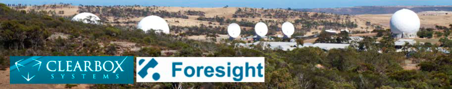
Kratos + Clearbox Systems to develop advanced dynamic satellite ground + SDA solutions
Kratos Defense & Security Solutions, Inc. (Nasdaq: KTOS) and Clearbox Systems Pty Ltd. have signed a collaboration agreement to co-develop and co-market solutions to advance the capabilities of software-defined satellite ground systems.

As part of the agreement, Clearbox will integrate their flagship Foresight product to run seamlessly on Kratos’ OpenSpace® dynamic ground platform. Foresight provides a unified user interface across essential ground functions including equipment monitoring and control, spectrum monitoring and network management.
Foresight can be deployed on physical, virtual or cloud infrastructure and, being web-based, can be accessed by users on any workstations connected on the network.
This technology is trusted by militaries, governments, satellite operators and commercial users large and small in Australia and globally in deployments ranging across SATCOM, ISREW, Crypto, OSS and Space Domain Awareness (SDA).
Foresight’s web-based, modular, distributed and open architecture makes it a natural application for running in the software-defined satellite network environments enabled by OpenSpace, the first and only commercially available virtual and orchestrated satellite ground system.
OpenSpace enables satellite and network operators to fully support next-generation satellites, dynamically provision services and missions, and integrate far better with the networks used by global terrestrial and cellular communications providers.
As part of the agreement, Clearbox will integrate Foresight with OpenSpace and enhance the product to take advantage of OpenSpace’s unique dynamic operating capabilities.
In addition, the two companies will work together to co-market each other’s products, Clearbox representing OpenSpace to its Australian customers and Kratos marketing Foresight globally.
Clearbox will also become Kratos’ primary representative in Australia for opportunities incorporating systems engineering, installation and support for several of Kratos’ other space networking products. Both companies will also work together to deliver SDA solutions that combine Clearbox’s SpaceAware product and sensors with Kratos’ global RF signal monitoring SDA network.
“We have been highly successful working with Kratos in the past and are extremely excited to be expanding that relationship moving forward. With this agreement we will be working together to develop new, advanced solutions for the global market.”
— Matthew Collins-Leslie, CEO & Managing Director of Clearbox
“Our experience with Clearbox has been extremely productive. Their people and technology are first-class, and we are looking forward to putting our heads together on the cause of advancing virtual ground system technologies to enable systems that are as dynamic, flexible and agile as smart phones are today.”
— Stuart Daughtridge, SVP for Advanced Technologies at Kratos
Rocket Lab launches NASA’s TROPICS constellation for storm monitoring
Rocket Lab USA, Inc. (Nasdaq: RKLB), a launch and space systems company, successfully launched the second of two dedicated Electron launches to deploy a constellation of storm monitoring satellites for NASA. This mission, named Coming To A Storm Near You, launched on May 26th, 2023, at 03:46 UTC, from Launch Complex 1 on New Zealand’s Mahia Peninsula.

Similar to the previous launch on May 8th, 2023 — Rocket Like A Hurricane — a pair of shoebox- sized satellites were passengered to LEO and they will collect more tropical storm data, more frequently, than other weather satellites already on-orbit.
The TROPICS CubeSats were launched to a specific 550 kilometer altitude orbit and with an inclination of about 30 degrees, as all four of the NASA TROPICS satellites must be deployed into their operational orbit within a 60- day period, just ahead of the 2023 North American storm season that starts in June.
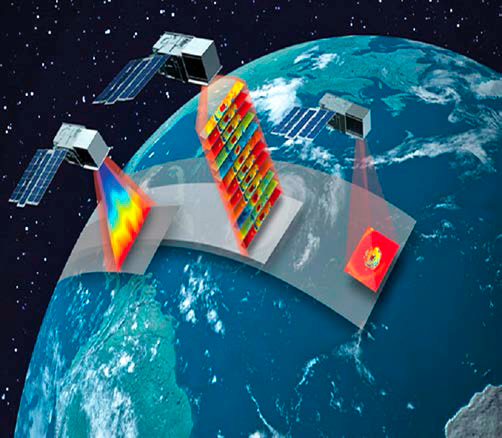
A constellation of identical 3U CubeSats
provide sounding (left CubeSat has a
temperature profile of a simulated Tropical
Cyclone (TC) from a numerical weather
prediction (NWP) model) and 12-channel
radiometric imagery (center CubeSat has
simulated radiances from NWP model and
radiative transfer model and the near right
CubeSat has a single-channel radiance image
of a TC) with a median revisit rate approaching
60 minutes to meet state-of-the-art performance.
Image is courtesy of MIT Lincoln Laboratory.
Coming To A Storm Near You wast Rocket Lab’s fifth Electron mission for 2023 and the Company’s 37th launch overall launch since the firm’s first, Electron launch in 2017.
The TROPICS launches follow on from previous, successful, Electron missions for NASA, including the ELaNa-19 mission and the CAPSTONE mission to the Moon.
“The TROPICS constellation has the potential to save lives and improve our knowledge of deadly storms, so we’re immensely proud to be part of making it possible. With one pair of TROPICS satellites now safely in orbit, we’re pleased to be back on the pad just two weeks later ready for the next launch. Regular and reliable dedicated small sat launch is what we developed Electron and our launch sites for, so it’s a great feeling to be delivering on that for NASA.”
— Rocket Lab founder and CEO, Peter Beck
SpaceX launches the Arabsat BADR-8 satellite to orbit
On Saturday, May 27, at 12:30 a.m. ET, SpaceX launched the Arabsat BADR-8 mission to a geosynchronous transfer orbit from Space Launch Complex 40 (SLC-40) at Cape Canaveral Space Force Station in Florida.
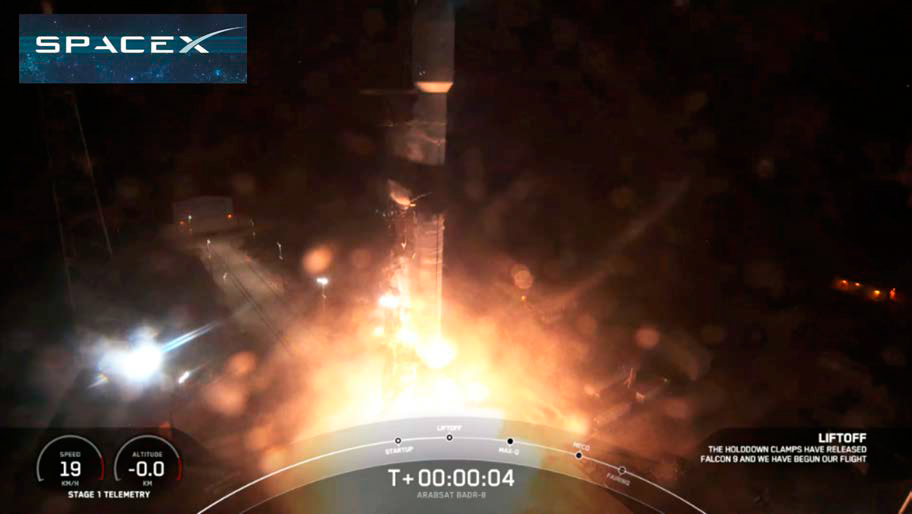
This was the 14th launch and landing for this Falcon 9 first stage booster, which previously launched GPS III Space Vehicle 04, GPS III Space Vehicle 05, Inspiration4, Ax-1, Nilesat 301, OneWeb Launch 17, and seven Starlink missions.
The satellite, built by Airbus, will provide connectivity over Europe, Middle East, Africa, and central Asia and also features a world first Airbus’ innovative space demonstrator TELEO to provide space to ground optical communicationsc at gigabit speeds.
The Airbus TELEO demo will be used to validate technical scenarios and innovations for GEO to ground communications of the order of one terabit per second.
This TELEO demonstrator will also enable very high capacity optical feeder link communications, by nature highly robust against jamming, as part of the development by Airbus of a new generation of optical communications technology in space.
Arabsat’s BADR-8 satellite features increased payload capacity and more efficient power and thermal control systems and will replace and increase Arabsat’s capacity and augment its core business at the BADR hotspot 26°E in geostationary orbit.
The state-of-the-art Airbus Eurostar Neo Arabsat BADR- 8 satellite features electric orbit raising technology and is the third Airbus Eurostar Neo satellite to be launched.
BADR-8 has been designed to remain in service in orbit for more than 15 years. The satellite has a launch mass of around 4.5 tons and it will deliver 17.8 kW of payload power. The satellite was transported to Florida on an Antonov An124.