
LEO, MEO, GEO, HEO — have you ever wondered why the U.S. Space Force (USSF) – and other space-faring entities select a specific orbit for their satellites?
The answer depends on a number of factors that include the satellite’s mission and the unique physics surrounding each orbital regime.

Colonel Daniel T.
Walter
“Orbit determination typically occurs in the early stages of design, weighing factors to optimize performance, resiliency, schedule and affordability,” said Colonel Daniel T. Walter, senior materiel leader, Strategic Missile Warning Acquisition Delta at Space Systems Command.
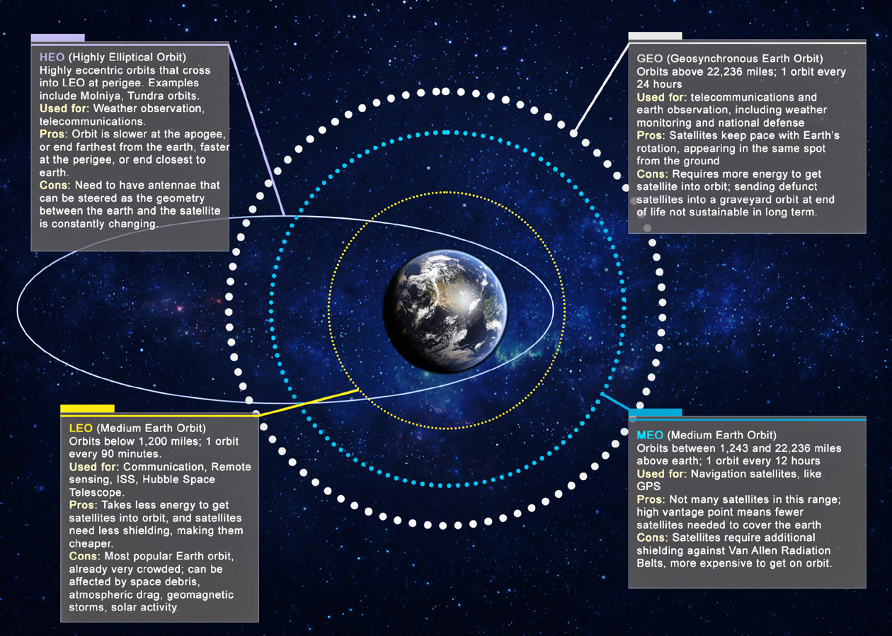
LEO (Low Earth Orbit)

Gregory Henning
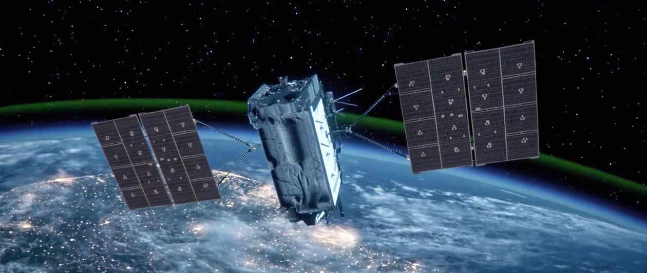
Orbits below 1,200 miles above the Earth are considered Low Earth Orbits (LEO) and are where most man-made object traffic — including the International Space Station and the Hubble Telescope — may be found, said Gregory Henning, a project leader who specializes in space debris simulations with the Aerospace Corporation, an independent, nonprofit corporation operating the only Federally Funded Research Center for the space enterprise.
“It’s the easiest orbit to reach — if you want to go higher than LEO, you need more energy to reach it. Maybe you go with a lower-mass bus (space vehicle) if you want to go higher,” Henning said. “You can get a lot more payload mass to LEO. There’s definitely a balance: you don’t want it to be too low, so that the atmosphere makes it really hard to stay ‘on station’.”
“Staying in LEO is cost-effective. If you go above that 2,000 kilometer imaginary line, radiation becomes a much bigger issue,” Henning said. “Spending a lot of time in that environment would require a lot more protection for astronauts.”

Kerstyn Auman
“LEO is used a lot for communications and imaging,” said Kerstyn Auman, a space situational awareness (SSA) analyst at the Aerospace Corporation. “One of the pros of this orbit is you have a really low latency (compared to other orbits) – how much time it takes to send out a signal and/or get one back. So, when you’re using voice communications or surfing the internet, you want it to be almost instantaneous.”
Because they’re so close to Earth, satellites in LEO also don’t need as much signal power to transmit and can be smaller in overall size, Auman noted. While there may be thousands of satellites in a LEO constellation to achieve global coverage, the individual satellites themselves can be as small as a cube satellite and can hitch a ride to orbit on a ride-share program.

Colonel Heather
Bogstie
SSC is looking to deploy missile warning/missile track/missile defense (MW/MT/MD) sensors in LEO and MEO orbits. Colonel Heather Bogstie, senior materiel leader for the Resilient MW/MT/ MD Acquisition Delta at SSC, noted that the U.S. Space Force’s current satellite architecture in acquisition was derived from the Space Warfighting and Analysis Center’s (SWAC) MW/MT/MD force design in 2022.
“This was the first mission area to receive a force design from the SWAC,” Bogstie said.
“This design presents us a Government Reference Architecture (GRA) placing Overhead Persistent Infrared (OPIR) sensors in various orbits — LEO and MEO — to deliver a robust set of OPIR capabilities to deter and defeat the emerging threat.”
Next Generation Overhead Persistent Infrared (Next Gen
OPIR) technology, in development, will deliver resiliency
in the face of emerging threats to missile warning, tracking,
and defense capabilities.
“This design is based on improved sensor technology paired with an abundance of commercial space vehicles to give us affordable options to place more sensors closer to the targets we need to detect and track,” Bogstie said. “In addition, by placing our sensors in varied orbits we gain multiple views of the same area and targets — enhancing our geometry with additional look angles and range. Overall, we gain increased detection and tracking accuracy. Having OPIR sensors in MEO and LEO layers really helps us track dim, fast moving targets better than we have in the past.”
However, one of the disadvantages of a LEO orbit is atmospheric drag — the main cause of orbital decay.
“Drag is the biggest perturbing force that basically alters where you would expect your satellite to be,” Auman said. “It can be a lot more difficult to predict your future location in LEO because you have drag; and drag is affected by solar weather — it alters the composition of the Earth’s atmosphere.”
“We have a general idea, but predicting that solar weather accurately is very difficult,” Auman added. “Better measurements of a satellite position and velocity can improve the knowledge of where exactly a LEO satellite is, and thus where it is going. GPS satellites, with a vantage point from a higher orbit, can be used to track LEO satellites and improve location accuracy.”
Satellites in LEO have to frequently burn fuel to maintain their position in orbit, or risk burning up as their orbit decays and they reenter Earth’s atmosphere. During periods of high solar activity, atmospheric drag can increase, and it may take more fuel to keep satellites on orbit, Henning said.
But this can also be a positive, Henning said. “The lower you are in LEO, the easier it is to dispose of your satellite at its end of life.”
A satellite orbiting at 500 to 600 kilometers above Earth doesn’t have to do much at the end of its useful life to exit its operational orbit and reenter the atmosphere, Henning said. However, if a satellite is orbiting at a higher LEO altitude — say 800 kilometers or higher — and is unable to perform a reentry maneuver, it could remain there for hundreds of years.
“It’s an exponential growth in density. People will ask ‘Where’s the edge of the atmosphere?’ There’s no edge — it just gets thinner and thinner as you go up,” Henning said. “Every kilometer you go higher in altitude, the atmosphere is thinning out exponentially. The difference between orbiting at 500 kilometers and 600 is not a 20 percent difference.”
 Click to enlarge.
As LEO becomes more and more crowded with new satellites, space debris has become a growing concern. An item of space debris might be quite small — but as objects in LEO must maintain a speed of about 17,500 miles per hour to maintain their orbit, even the smallest chunk of metal can cause a lot of damage if it collides with another space vehicle.
“On an international level, playing ‘traffic cop’ in space is a very messy topic,” Henning shared, noting that no one entity “owns” space. “Most nations want space to be usable, not only for them, but for humanity as a whole.”
“Formal coordination to place a satellite in orbit is accomplished through various U.S. government and international organizations to ensure equitable access and efficient use of frequencies across the space domain,” Walter said. Often, this is focused on frequency use and allocation over various parts of the world. The International Telecommunications Union (ITU) is the governing body, which manages these international and treaty-based processes.
In terms of space traffic management, many nations have tracking stations — either using radar or optical telescopes, Henning noted. The U.S. Department of Defense’s Space Surveillance Network — in particular U.S. Space Force’s 18th Space Defense Squadron — tracks space debris and space vehicles, both operational and defunct. If there’s a possibility of a collision, satellite operators are warned so they can take precautionary maneuvers.
“When you think of the U.S. and other nations, we have standards and practices in place that specify what missions have to do in terms of end-of-life disposal to ensure that they are minimizing their threat to collide with other satellites or minimize the risk of exploding on orbit,” Henning said.
Artistic rendition of a NOAA GOES-R satellite, courtesy of the agency.
The U.S. Orbital Debris Mitigation Standard Practices (ODMSP) calls for defunct satellites to deorbit LEO within 25 years of their end of mission, but the Federal Communications Commission, which licenses U.S. satellites, last year adopted a limit of five years, Auman noted.
“If you have a satellite that stops operating and doesn’t do any maneuvering, and it’s at somewhere around 500 kilometers or less, there’s a good chance it’s going to comply and it’s going to come down within 5 years or less,” Henning said. “If you’re at 600 or 700 kilometers, suddenly that could become 10, 20, 50 years very quickly.”
In addition to altitude, another factor is the orbital plane, or the satellite’s inclination, which can provide a bit more room in LEO. The fact that the Earth is not a perfect sphere but slightly oblate around the equator means this region also has an unusual orbit known as a Sun Synchronous Orbit where satellites with a greater than 90 degree inclination can cross the equator at the same time every day, Henning explained. This orbit is highly coveted for applications such as climate, observation or national defense satellites.
MEO (Medium Earth Orbit)
Orbits between 1,243 miles and 22,236 miles above Earth are Medium Earth Orbits (MEO) and have an orbital period of about 12 hours. Satellites only have to maintain a velocity of 7,000 miles per hour to stay in orbit. The main influences are the sun and the moon’s gravity and that means station-keeping is easier than in LEO and requires less fuel, Henning said.
“In MEO, you’re away from that drag environment that makes it fairly difficult to know a satellite’s position with a high degree of accuracy,” Auman said. “You do have to worry about solar radiation pressure, but it’s a much smaller perturbing effect on satellites than drag is.”
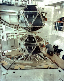
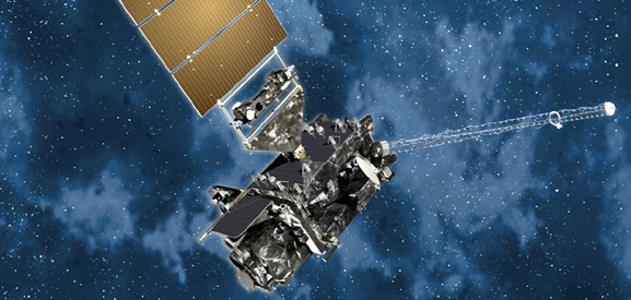
Vela satellite payload. Image is courtesy of
the DoD.
One of the main advantages of the MEO orbit is that satellites have a higher vantage point and it takes fewer of them to cover the Earth. This makes it ideal for applications such as navigation satellites, including GPS, Henning said.
“There isn’t actually a whole lot in MEO aside from the navigation satellites,” Henning said. “If you were to try to do the GPS mission in LEO, you would require an enormous number of satellites.”
“The trade-off is, the further away from Earth that you go, the stronger your transmit power beam needs to be; thus, the larger your equipment and the bigger your satellite. So, it costs more to launch further into orbit,” Auman said.
MEO also includes the two zones of energetic charged particles above the equator known as the Van Allen radiation belts, which can damage satellites’ electronic systems without special shielding.
“Another thing that comes out of going to these higher orbits is that the satellite buses are bigger,” Henning said. “Usually, you try to pack a lot more into them, and they become more expensive and more important as a single entity. For example, losing a GPS satellite would be a much bigger deal than losing a single Starlink satellite (in LEO) because there are so many of them.”
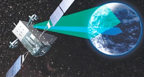
Among the advantages for satellites in MEO is that these sensors are closer to the Earth than the legacy Defense Support Program (DSP) and SBIRS satellites in GEO, which reduces the size and complexity of the optics needed to perform the new missile warning and tracking mission, Walter said.
“The satellites don’t persist over the same swath of Earth like a GEO system, but with enough assets, they can work as a family of sensors to achieve the same effect,” Walter said. “To meet very short timelines, the satellites need to depend on a combination of space and terrestrial networks to get the crucial information to strategic decision makers, combatant commanders and the missile defense community.”
“Sensors orbiting in MEO have longer target area pass times than LEO systems and wider fields of view,” Walter added. “MEO sensors can maintain custody of missile tracks for longer periods of time, because the higher altitude allows for a larger field of view.”
“The multi-orbit approach to space sensing gives us the opportunity to exploit the decades of previous work in OPIR technology development,” Bogstie said. “By expanding across orbits, we’re increasing the resiliency and accuracy of our existing systems for the Space Force.”
“As we continue to innovate and enhance what systems are placed in each orbit and then create connections between orbits, we open up joint warfighting opportunities we have never seen before,” Bogstie said. “Couple this with rapid commercial technical innovation and future allied systems, and we have a truly robust sensing network emerging.”
GEO (Geosynchronous Orbit)
Geosynchronous orbits are 22,236 miles above the equator and complete one revolution every 24 hours. These orbits are mainly used for weather monitoring — such as the National Oceanic and Atmospheric Administration’s (NOAA) GOES system — communications and national defense. GEO orbits are easier to track from the ground because the satellite always appears to be in the same position relative to Earth.
The key difference between a geostationary orbit and a geosynchronous orbit is while a geosynchronous orbit can have any inclination, a geostationary orbit sees satellites permanently ‘parked’ over the plane of Earth’s equator with a zero degree inclination.
“The magic of a GEO orbit is if you’re sitting on the ground, and you know where that satellite is, it’s not streaking across the sky – it just sits right there,” Henning said. “Television has used that orbit quite a bit — satellite TV will have a dish on the roof pointed at that one spot in the sky.”
“It’s also a very powerful platform for national defense and surveillance as well,” Henning noted. “If you can plant a satellite that can essentially stare (at one spot) and it doesn’t have to worry about flying over and gimballing its sensor or its camera to capture an image – it canbcapture an image of a region at any time of day from GEO any time it wants, as long as it’s sitting above that point on Earth.”
However, much like MEO orbits, it costs more to put a satellite into GEO. It also takes longer for a signal to make its way down to a receiving station from GEO, which can introduce lag times in applications such as satellite internet, Henning said. The extremely high altitude also can make it difficult to get clear images without using very complex and expensive instruments.
The effects of the moon and the sun’s gravity also become stronger in GEO than in MEO, Henning said.
“If you plant something in a geostationary orbit, it’s not going to stay there — there’s station keeping that has to be done to keep it in that longitudinal box — otherwise you’ll drift East or West,” Henning said.
This design is based on improved sensor technology paired with an abundance of commercial space vehicles to give us affordable options to place more sensors closer to the targets we need to detect and track. Overall, we gain increased detection and tracking accuracy.
“Overhead Persistent Infrared satellites have traditionally been placed in GEO or HEO orbits,” Bogstie said. “Our satellites in these higher orbits are large with exquisite sensors and are placed in GEO and HEO to give them a wide field of view. However, as the threat and ballistic missile technology has changed, particularly with regard to hypersonic missiles and hypersonic glide vehicles, the need to detect and track dim and fast-moving targets drives us to a different architecture.”
In order to defeat emerging threats, “we need to look at the way we are doing business and consider what changes we need to make to our operating systems, and the way that we are fielding these systems,” Bogstie said. “We’re talking now about pivoting our missile warning systems to the LEO and MEO layers of the earths’ orbit so we can better track these different types of capabilities across the course ofntheir operations.”
HEO (Highly Elliptical Orbit)
HEO orbits are elongated ellipses that pass through LEO at the perigee (their closest approach to Earth) with apogee (the furthest point in their orbit) above GEO. HEO orbits can be used for weather observations or surveillance. The Vela satellites that the U.S. launched in the 1960 to detect nuclear detonations also used a HEO orbit.
